Introducing the Broads National Park and some of its most beautiful villages
The Broads National Park, or simply The Broads, is home to some of the most beautiful villages in Norfolk. It is also the most emblematic national park in East Anglia. The Broads is part of the 15 UK national parks and is home to a diverse ecosystem. With over 200km of wildlife and breathtaking landscape, the Broads offer countless options for outdoor lovers. One can walk, cycle, take a boat ride or simply enjoy one of the many idyllic villages located around the park.
You can reach The Broads National Park from Norwich, Salhouse, Hoveton & Wroxham, Worstead, North Walsham, Gunton, Roughton Road, Cromer, West Runton and Sheringham. These cities and villages are connected through Bittern Lane, a train route which makes possible communication between these beautiful cities and villages in The Broads. The regional train operator is Greater Anglia. Some other smaller places can only be reached by bus.
The Broads is only two hours away from London, making it ideal for a weekend away in nature. Norfolk County is also close to one of the busiest London airports (Stansted). There are direct train services from London (Stansted) to Norwich, which can get you to the Broads in approximately two hours. You may be able to purchase train tickets to Norwich from the train operator, Greater Anglia.
Travel to The Broads National Park and visit some of its most beautiful villages: Hoveton & Wroxham
If you decide to visit the Broads, your possibilities are countless. You can choose a weekend away in which case I would advise you to book your accommodation closer to the village/city you intend to explore. Alternatively, you can set up your base in Norwich and travel from here to the park since the furthest point (Sheringham) is only 40 min away by train.
Hoveton & Wroxham, two beautiful Norfolk villages, are often called the gateway to the Broads. The two villages are one of the most popular choices for those who decide to visit the Broads. By train, from Norwich, Hoveton & Wroxham, are only 15 minutes away. A return train ticket bought at the train station is around 6,40 GBP. The price ticket can vary slightly depending on whether you opt for an on-peak/off-peak train ticket. You can purchase the train ticket from the same train operator, Greater Anglia, either online, via their mobile app or at the train station in Norwich.
By car, Hoveton is 20 minutes away from Norwich. You must take Wroxham Road and then A1151 road. Car parks are available throughout Hoveton, with most of them concentrated on Station Road.
How to enjoy the most of Hoveton & Wroxham, two of the most beautiful villages in The Broads?
There are plenty of outdoor activities catered for all types of fitness levels. The most popular ones are walking, biking or boat riding.
Boat trips are a popular activity visitors opt for while in Hoveton. There are boat hire facilities everywhere in the village. You can opt for private boat hire or group tours. For more information on what is available on the day, please visit the Hoveton Visitor Centre (on Station Road, in Hoveton). Most rental boat facilities are around the Wroxham Bridge (Broads Tours, Wroxham Broads Hire, The CanoeMan Wroxham and Wroxham Launch Hire).
Take a walk in Hoveton. The village centre starts on Norwich Road and continues onto Stalham Road. Most of the shops and restaurants can be found on Norwich and Stalham Road. There is a McDonald’s and a Roys Store as well. Smaller independent restaurants, as well as local bakeries, can be found along Norwich Road. Everything you need is in Hoveton. Wroxham is more of a residential area that’s half an hour walk from Hoveton. However, there isn’t anything to visit or do in Wroxham, except for admiring the posh English mansions.
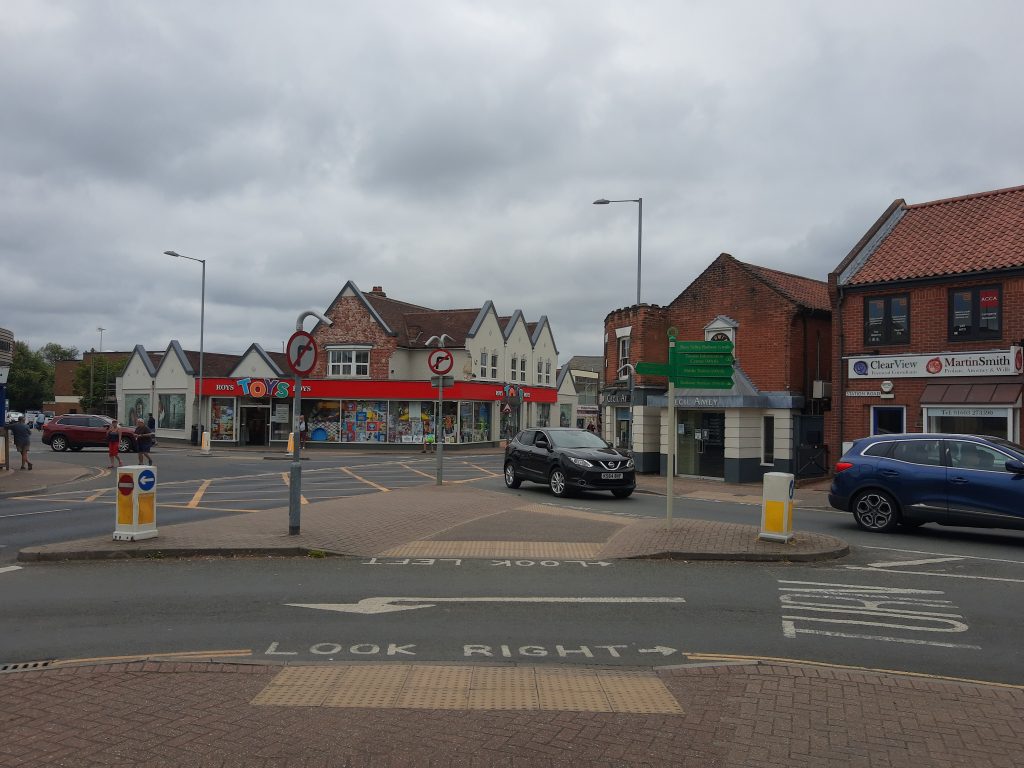


Hikes/Bike rides are also popular. Hoveton might not be very big. However, it’s the start point for many walking trails which connect the village with nearby even smaller places.
Walking Trails
There are several hiking trails around Hoveton. However, the hiking trails I will talk about in this post start in Hoveton (close to the train station). These walking trails options help those of you travelling by public transport who don’t have a car to reach more isolated countryside areas.
- Stroll by the River Bure. River Bure cuts through the village of Hoveton. River Bure is navigable, but it’s only used for tourism purposes nowadays. The area around the River is accessible on foot and integrates some of the most extensive hiking trails which eventually expand beyond Hoveton. This walk is only 2km long and includes a walk from the train station, along River Bure, up to Norwich Road. This walk is very easy and suitable for anyone regardless of their fitness level. For this walk, you will need to follow the following steps:
As you exit the train station and reach the bottom of the stairs, you will see the sign below. Follow the Path to River direction.
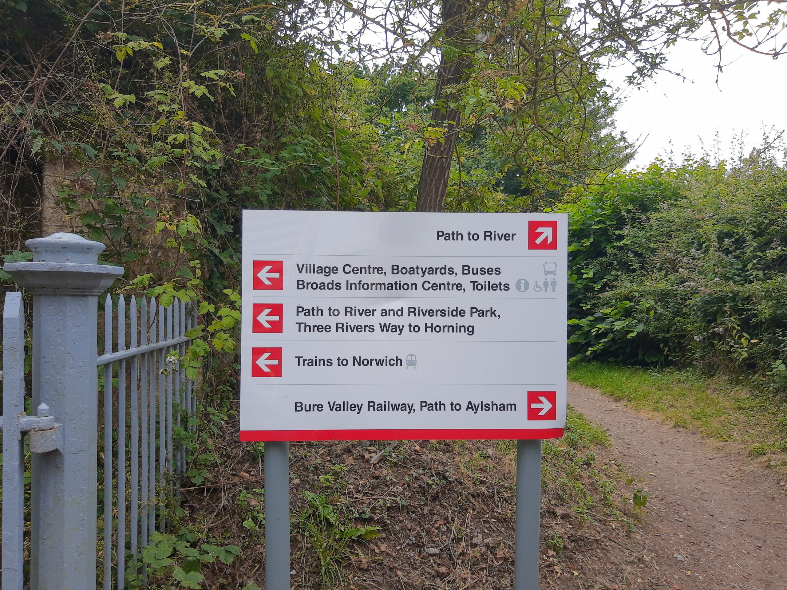
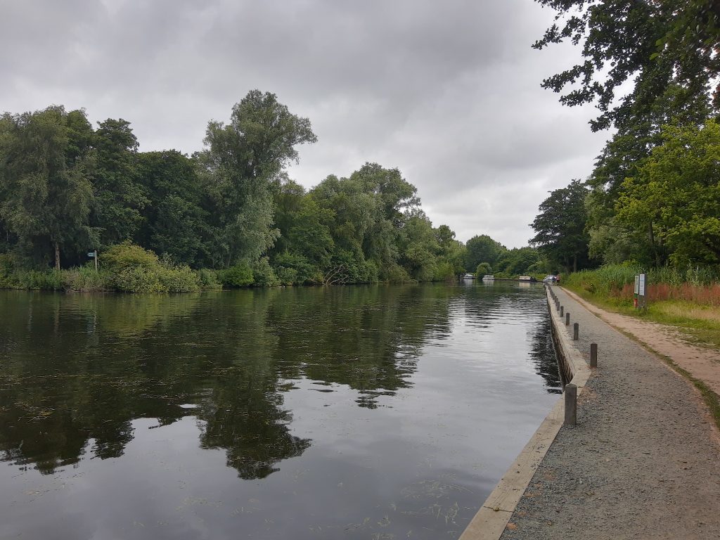
At the end of the path, you will have two options. The right path will take you to a dead-end area of River Bure. You can still check out this area, but you will need to return to this same spot to continue your walk into Hoveton.

This is how the dead-end point looks like.


Now, that you have covered the dead-end area, continue your walk into Hoveton by following the path walk. Norfolk Road (aka the village centre) is less than 10-15 minutes away at this point.
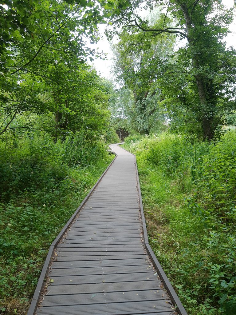


An alternative to this walk is to reach the village centre by exiting the train station and turning right on Station Road. You will continue walking on Station Road until you see the big McDonalds. At this point, you would have arrived in the village centre. I’ve walked both ways. However, the walk along the river is much more beautiful and picturesque.
2. A second hiking trail you can try is longer. This second option is around 13,53 km long and it gets you out of Hoveton. Because the hiking trail it’s in the shape of a loop, you will eventually end up in the same place you started. To start this hike, you will need to head to Bure Valley Railway-the steam train station. You can also take the steam train to cover more of the Broads area. For this hiking trail though, you won’t need to get any train.

Once you find the steam train station, walk behind it until you find the path that follows the train tracks as you can see in the pictures below:
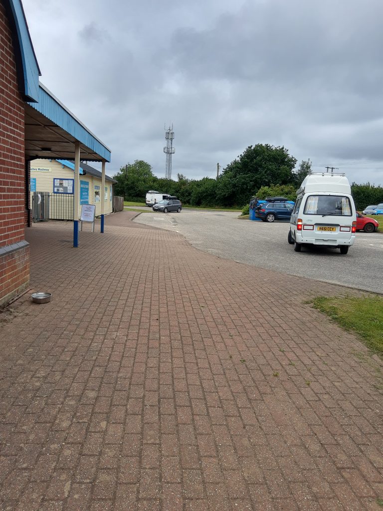


Continue walking straight, you will cross a road junction and you will see a train barrier on your right-hand side. After the road junction, you will need to be careful not to miss the red brick bridge.
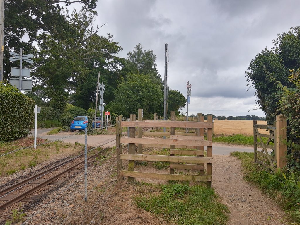

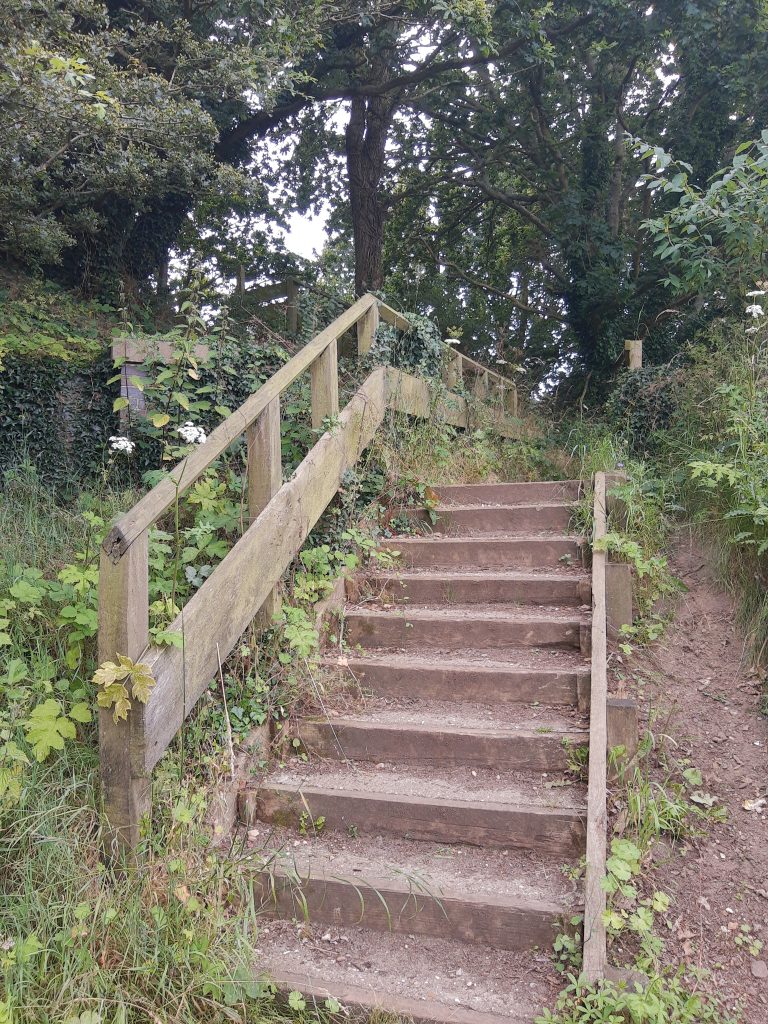
Immediately after the bridge, turn left and take the stairs to get on the main road. Once you are on the main road, turn right and continue walking.

Continue walking on this road until you get to the next junction. As you can see there is no pavement, so make sure you pay attention to the traffic and give way to cars coming either way. At the next junction, turn right as indicated in the picture and continue until the road gets very narrow as shown in the final picture:
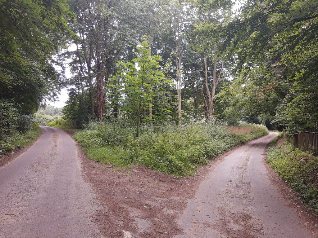


Once the road gets very narrow as shown in the last picture above, turn left. Now, you have 2 options: you either take a path that’s straight in front of you or take the public footpath that’s more to your left. You must take the public footpath that’s more to your left.
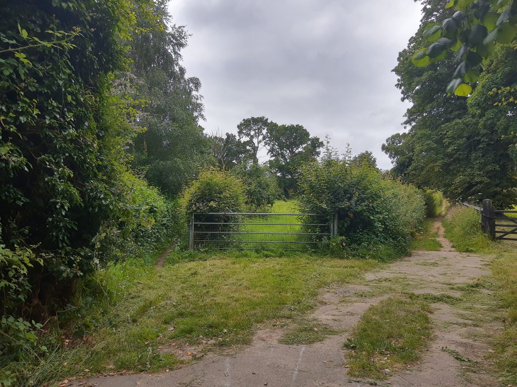

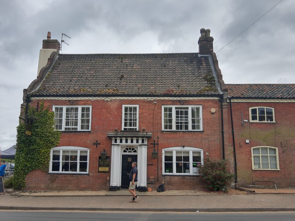
At the end of this public path, you will end up in Coltishall where you should be able to see Kings Head Inn across the street and a telephone cabin on the left-hand side. There is also a post office across the road. At least you will see some civilization after spending some time in open fields and deserted country roads. Now, go towards the inn’s car park and walk diagonally. At the end of the car park, on your left-hand side, you will see a bridge. Cross it and continue towards the end of the park.


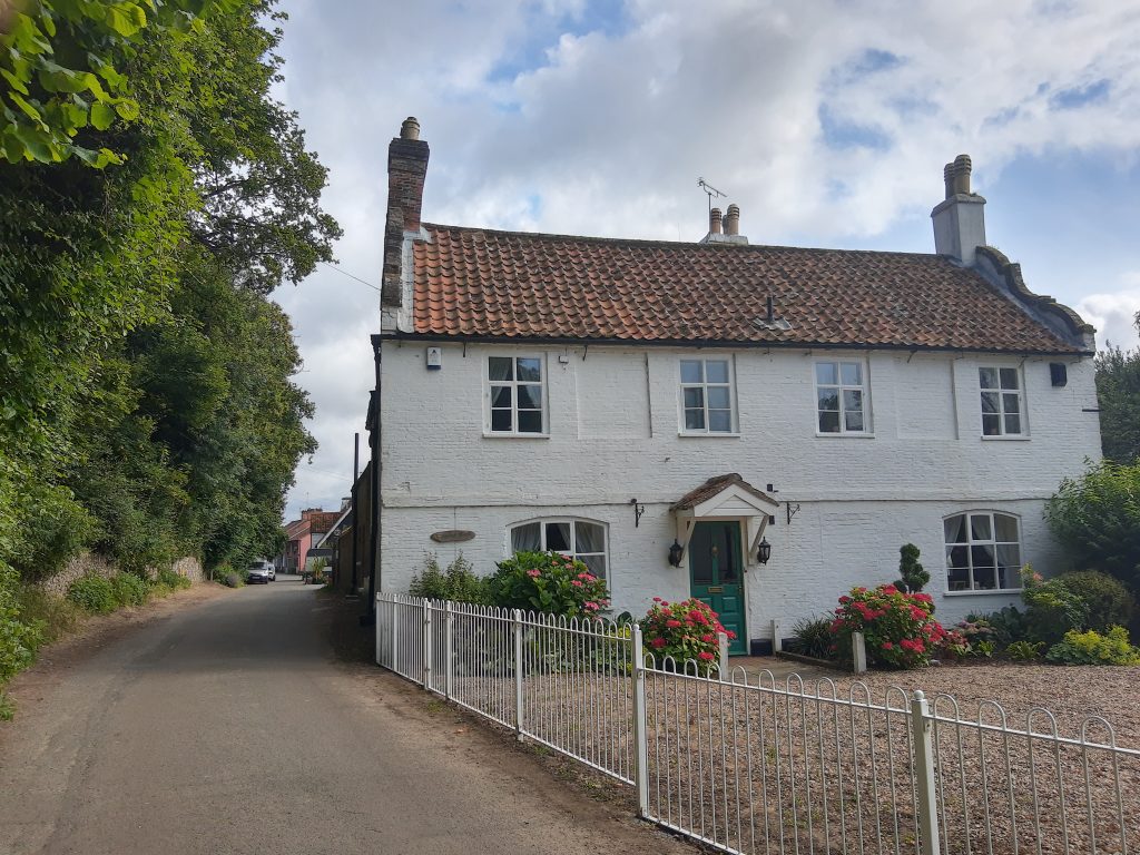
At the end of the park, you will see a wall. Go around it and continue walking straight onto the road until you reach the end of the street. You will see beautiful cottage houses on your right-hand side as you get to the end of the street.
At the end of the street, you will get to a meadow. This is where my hiking route changed and I had to improvise a returning route to Hoveton. I changed my hiking route because I came across 10+ very inquisitive cattle and decided to return.
I would have probably continued if the people in front of me would have not walked back. However, because the animals were getting closer and closer, and there were quite a few young bulls as well, I considered it was not safe to walk through them to continue my hike. This is the beauty of hiking. You always have to be open to changes. Luckily, even if I altered the route, the walk was still enjoyable.


When I decided to get back, I headed back to Anchor Street, turned right on the same Anchor street and ended up on Wroxham Road. Here, you could walk back to Hoveton by following the Wroxham Road. However, the road is busy and there is no pavement, so I did not feel safe. Instead, I did what some locals advised me to do. I crossed the road and walked back to Hoveton via Belaugh Green Lane. It’s much quieter and there isn’t that much traffic.
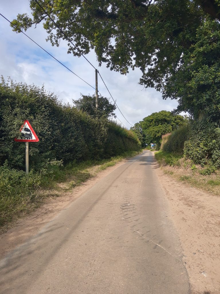


At the end of Belaugh Green Lane, you will see the same train barriers you passed by earlier in your walk. Turn right and continue walking along the train tracks. They will take you back to Hoveton. At this point, you should recognise the hiking trail because you’ve already walked this portion of it. This is my modified hiking trail. The original route would have been this one. I stopped between numbers 9 and 10.
These walks are part of bigger hiking trails called Bittern Line walks. As I might attempt to do some other walks in the Broads using these trails, I will feed it back to you and let you know what I found difficult and what was easy. I am not a very experienced hiker, but I would say this walk was pretty easy. The terrain has been mostly flat (except for some steps I had to climb at some point). Maybe the distance might constitute an impediment for some walkers. However, as you’ve seen in my case, you can cut it short. You don’t need to walk the entire trail.
Both walking trails I suggested in this blog post, could be good biking routes too. There might be some portions of the trail where you might need to get off your bike, but in general, I would say is doable. You can judge it yourself by looking at the pictures I provided.
Alternatively, you always have the option of taking the steam train. This way you can obviously cover more of the region than you would do by walking or biking.
Budget & Safety
The UK is widely known as being a safe country. However, if you read my previous blog posts, you will see that I stick to some basic safety rules wherever I go. One of these rules is to complete my activities by the time it gets dark. So even if I started the hike after midday, I made sure I was back at the train station before it got dark. This is the one golden rule I stuck to for the last 10y as a solo female traveller. Except for that, there are no other serious safety concerns, except for the cattle when they are left free.
The UK is generally known as being an expensive country and this is true. However, you can still get good deals like this trip where I managed to spend less than 10 GBP/11.70 Euro for food and transportation on the day. If you travel from Norwich, the return train ticket is around 6 GBP. For your meal, you could go with one of the meal deals you can purchase from any UK supermarket. The most affordable is Tesco. For only 3 GBP, you get a sandwich of your choice, a drink and a snack. These types of meal deals are perfect for budget travellers.
Hoveton and Wroxham are indeed some of the most beautiful villages in The Broads. If you want to experience the authentic English countryside, you should definitely add it to your list with places to visit in the UK.
Are you more of a big city fan or a village and nature lover? Would you consider visiting Hoveton and Wroxham, two of the most beautiful villages in The Broads, next time you are in the UK? Let me know your thoughts on the UK countryside below.
Did you like this blog post? Then, pin it!


Gorgeous presentation
Thank you so much!
Hey no thanks you like my posts
Hoveton & Wroxham certainly do look beautiful! I love learning about new places!
I love walking in English towns and would enjoy hikes in this countryside. Thanks for sharing this lovely area.
I’ve not explored this part of the country, I need to get out of my London bubble more often!
I’ve never explored the English countryside! I would love to, though, the next time I am in the U.K. These spots look like awesome locations to visit. Thank you for sharing!
Lovely post – it’s amazing how many hidden gems there are in England 🙂
Indeed, England is packed with such beautiful places! 🙂
Love to see this area.
I love Norfolk, it’s such a beautiful county, so I’ll try to write as many blog posts about it as I can. I’m glad to read so many people like the posts on Norfolk. 🙂
English countryside looks like a dream and I had never heard about Hoveton and Wroxham but they look stunning! Thanks for sharing this guide.
Thank you so much for your kind words, Nishtha. I’m very happy you like Hoveton and Wroxham. Indeed, Norfolk seems to be less known, so I’ll do my best to write more about it because there is so much more to do and visit in this part of the country 🙂
Pingback: Popular walking routes-discover Norwich on foot! – The Next Epic Trip
Pingback: One easy walk near Norwich for beginners (Circular walk in Salhouse) – The Next Epic Trip
Pingback: Norfolk’s hidden villages: The best walk in Barnham Broom! – The Next Epic Trip
Pingback: Where to go for walks around Norfolk this spring? – The Next Epic Trip